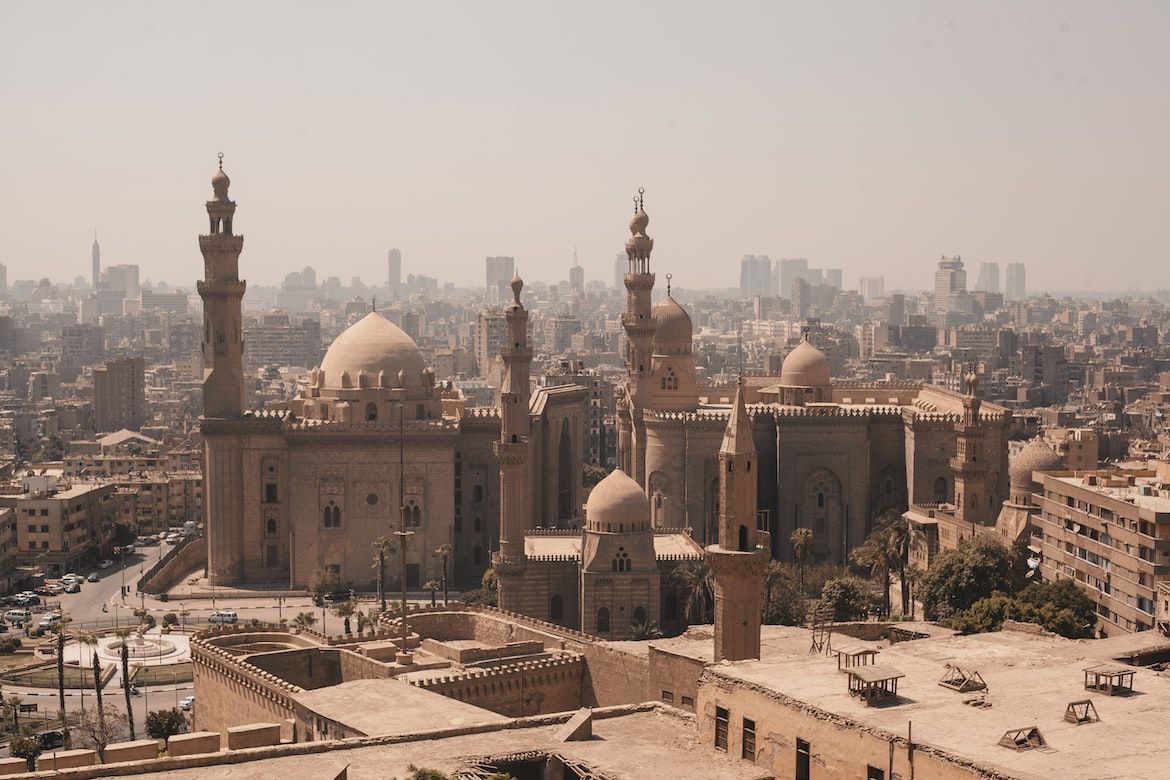
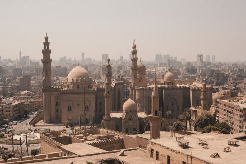
Nile river
Geography

Facts about Nile river

We found 17 facts about Nile river

The cradle of ancient North African civilizations

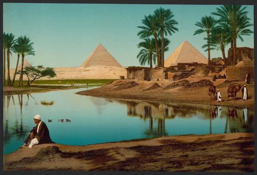
Thanks to its annual floods, the Nile became the lifeblood of many Egyptian peoples long before the rise of ancient Egypt. For a long time, people have been searching for the source of the Nile, with the first attempts in the first century BC. It was not until the 19th century that it was found thanks to European explorers.

Nile river
1
The Nile is the longest river in Africa.
Until recently, it was also considered the longest river in the world, but in the face of recent research, it turns out that the Amazon is slightly longer.
2
It is 6650 kilometers (4132 miles) long.
It flows through all climate zones in Africa, and its basins are located in the territory of eleven African countries: Burundi, Egypt, Sudan, South Sudan, Eritrea, Ethiopia, Kenya, Democratic Republic of Congo, Rwanda, Uganda and Tanzania.
3
The source of the Nile, sought after for thousands of years, turned out to be the Kagera River.
It was discovered by Henry Morton Stanley in 1876. The Kagera is 400 km (248,5 mi) long and flows through the territories of Rwanda, Burundi, Tanzania and Uganda.
4
The Nile has two main tributaries, the White Nile and the Blue Nile.
The White Nile is considered the source and main stream of the Nile, but the Blue Nile accounts for most of the water flowing into the river. The White Nile has its origin in the African Great Lakes region, while the Blue Nile in Lake Tana in Ethiopia. The two rivers join north of Khartoum, the capital of Sudan.
5
From Khartoum, the Nile flows in a northerly direction.
It flows through the Nubian desert in Sudan, Aswan, Cairo to Alexandria, where it enters the Mediterranean Sea.
6
The Nile River basins cover 3 254 555 km² (1 256 590 sq mi), about 10% of Africa.
Despite its extensive water system, the Nile is not a fast-flowing river and transports relatively little water. In comparison, the Congo River carries about 20 times more water. The water flow of the Nile is determined by many environmental factors such as the amount of precipitation, direction of flow, water evaporation, and groundwater flow.
7
The Nile Delta covers an area of about 22,000 km² (8 494 sq mi).

It begins in the suburbs of Cairo, about 175 km (109 mi) south of the Mediterranean coastline. At Cairo, the Nile splits into two arms:

  • Damietta - the eastern branch with a length of 240 km (149 mi).
  • Rosetta - western branch with a length of 325 km (202 mi).

Areas of the Nile Delta are very well managed and cultivate many crops such as wheat, rice, cotton and sugar cane.
8
In ancient Egypt, the river was called Iteru.
It was along the Nile that ancient North African civilizations such as Egypt and the kingdoms of Sudan developed.
9
As early as the Stone Age, people were settling in the Nile Valley.
The largest population center was north of present-day Aswan. Ancient Egyptians sang a hymn to the Nile, thanking the river for being and bestowing wealth on their country.
10
The Greek historian, Herodotus, called ancient Egypt "the gift of the Nile."
Thanks to the fact that the river flooded every year and deposited layers of fertile silt on the surrounding land, agriculture could develop here. Ancient Egyptians cultivated wheat, flax, and papyrus in the nearshore areas of the Nile. Most agricultural production was used for Egyptian needs, but the surplus was traded, which hugely impacted the development and wealth of this ancient civilization.
11
The course of the river was quite different before and during the period of the last glaciation.
The Nile flowed through an area of eastern Libya at what we now call Wadi al Hamim and Wadi al Maqar and into the Gulf of Sidra, which is more than 1,000 km (620 mi) west of the river's present mouth. When the water level rose at the end of the last ice age, most of the water began to flow through the current riverbed. The current riverbed begins near the present-day city of Asjut in Egypt.
12
The Red Nile - an episodic river.
One of the major tributaries of the Blue Nile is the Atbara River, commonly known as the Red Nile. This 800-km-long river appears periodically during the rainy season and is fed by rainfall from areas of Ethiopia. When the rainfall stops, the Red Nile dries up rapidly.
13
Yellow Nile - a tributary of the Nile, mentioned by Ptolemy and Herodotus.

Like the Red Nile, Wadi Howar (Yellow Nile) is fed by rainfall and is now an episodic Nile tributary.

Between 8000 BC and 1000 BC, it fed the Nile continuously with waters from the Ouaddaï highlands located in Chad. It was a vital settlement site between central Africa and the Nile Valley and was one of the major tributaries of the Nile from the Sahara area, which was then a grassland.

14
Already in ancient Egypt, the river was a critical transportation route.
The boats were used, for example, to transport 80-ton blocks of red marble quarried in Aswan, which served as the building material for the royal chamber in the Great Pyramid of Giza erected more than 4,500 years ago.
15
Most Egyptians today still live in the Nile Valley area.
16
In 1951, American John Goddard and two French explorers were the first to swim the entire river successfully.
The 9-month expedition began at the source of the Nile in Burundi. Explorers covered about 6 800 km (4 225 mi) before reaching the mouth at the Mediterranean Sea.
17
Despite many reservoirs built on the river, a drought in the 1980s caused a massive famine in Ethiopia and Sudan.
Thanks to Lake Nasser, Egypt avoided disaster, but countries further south were not so lucky. Of the 70 drought events between 1900 and 2012, 55 affected Ethiopia, Sudan, South Sudan, Kenya and Tanzania. According to a Strategic Foresight Group report, about 170 million people have been affected by droughts in the past century, from which half a million have lost their lives.
Hungry for more facts?

Latest topics

42 facts about Kyshtym disaster
The first nuclear accident in Earth's history
Before information about it saw the light of day, the Soviets hid it for over 30 years. The explosion at the Mayak combine was the first nuclear accid ...
37 facts about Saint Petersburg
A city of many names
It was a dream and a matter of prestige for the Romanov dynasty to gain access to the Baltic Sea and build a metropolis to testify to Russia's emergin ...
32 facts about Peter the Great
The first Emperor of all Russia
Peter the Great is considered one of Russia's greatest rulers. He was a great reformer, strategist, and builder who was the first of the tsars to trav ...
39 facts about Dyatlov Pass incident
Mysterious tragedy in the Ural mountains
The case of a group of students at the Ural Polytechnical Institute in Sverdlovsk continues to arouse great interest and raise many questions. A group ...
11 facts about Brooklyn Bridge
The first steel suspension bridge in the world
It is one of the oldest suspension bridges in the world. It connects Brooklyn with Manhattan, runs over the East River, and was completed in 1883. ...
31 facts about Brazil
South America's largest country
Brazil is the largest and most populous country in South America and one of the largest and most populous countries in the world. A former Portuguese ...
44 facts about Ghent
City of three towers
Ghent is one of Belgium's most visited cities by tourists. This beautiful old Flanders city combines dignity, beauty, culture, and creativity. It is a ...
31 facts about Thailand
A country on the Indochinese Peninsula
Thailand is an Asian country located in its south-eastern part, famous for its interesting culture and religious architecture. This exotic country, wh ...

Similar topics