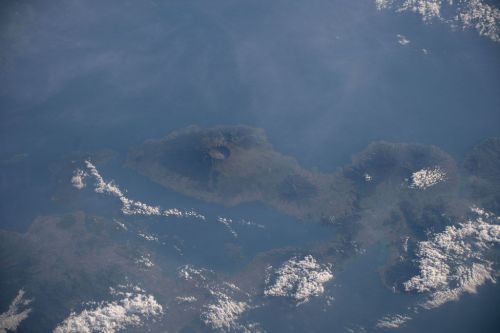
Cotopaxi is one of the highest active volcanoes. It is a stratovolcano with an almost perfect cone, which has always been an object of worship for the indigenous Andean people as the place where the gods reside. He also provided water that gave fertility to the soil.
At the same time, it was and still is a huge threat, because the eruptions of this volcano are frequent and extremely destructive.
As a tourist attraction, it is protected by the Cotopaxi National Park, the first national park in the continental territory of Ecuador.
It is located in the province of Cotopaxi, near the city of Latacunga in Ecuador. It is a stratovolcano (compound volcano).
A stratovolcano is a cone-shaped volcano made of many layers of hardened lava and pyroclastic material emerging from its interior. The cone is made of pyroclastic material (boulders, stones, volcanic bombs, pumice, volcanic ash, dust). The stratovolcano's magma is characterized by relatively high viscosity and high silica content. It does not spread widely; it solidifies quickly, building subsequent layers (strata), hence the name of this type of volcano. Stratovolcanoes are characterized by a large slope angle.
Stratovolcanoes include Cotopaxi in Ecuador, Etna, Vesuvius, and Stromboli in Italy, Teide in Tenerife, Erebus in Antarctica, Hekla in Iceland.
It is one of the highest active volcanoes in the world - its height is 5897 m above sea level.
It has been active for over four thousand years. The strongest eruption took place at the turn of 1532 and 1533, and as a result, the city of Tacunga was destroyed. Violent eruptions occurred in 1742, 1744, 1768, and 1877. The eruption in 1744 was heard in Colombia, 800 km away.
The 1742 eruption was witnessed by French scientists and members of the French Geodetic Mission as they descended from the nearby stratovolcano Guagua Pichincha.
The last eruption took place in 2015 and lasted for over five months. Ash and steam were coming out of the volcano. Ash deposited in areas around the volcano, destroying farmland, and also reached the outskirts of Quito, the capital of Ecuador.
It has an almost symmetrical cone, at the top of which there is a crater with a diameter of 800 by 550 m and a depth of over 360 m. It consists of two concentric rims, the outer of which is partially devoid of snow and has an irregular shape. The interior of the crater is covered with ice cornices and is flat.
The highest point is on the outer rim of the crater on the north side.
The boundary of eternal ice begins at an altitude of approximately 5000 m above sea level.
The local Andean people worshiped this mountain as the one that sent rain that guaranteed the fertility of the land, and its peak as the seat of the gods.
It only reached an altitude of 4500 m above sea level. In 1858, the German explorer, geographer, and collector Moritz Wagner explored the mountain, but he also failed to reach its peak. Only in 1872, the Cotopaxi peak was conquered by the German geologist Wilhelm Reiss, together with his Colombian companion Angel Escobar.
The peak was conquered for the second time in 1873 by a German geologist and four Ecuadorians, and in 1880 it was conquered by a British mountaineer who spent the night on the peak.
At the end of the 20th century, conquering the Cotopaxi Peak became the main tourist attraction in Ecuador. On Easter 1996, a tragedy occurred there when an avalanche buried the shelter built at an altitude of 4,864 m above sea level. Dozens of tourists were trapped under the snow.
The park was created in 1975 in an area of 334 km2. It is the first national park created on the continental territory of Ecuador. Its ecosystem is home to several species of trees, especially South American pines.
The tributaries of several rivers flow from the slopes of Cotopaxi and the second volcano located within the park - Rumiñahui, including Cutuchi, Pita, and Tambo.
Many mammals live in the park, including bears, llamas, wolves, foxes, pumas, snow goats, as well as birds: condor and eagle.


