Geography

Facts about Mount Pinatubo

We found 21 facts about Mount Pinatubo

Bunduk Pinatúbû

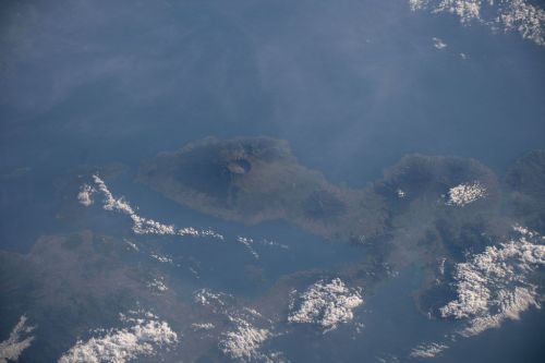
Mount Pinatubo is located in the Philippines. It gained its fame after a deadly eruption in 1991, that took the life of hundreds of people, and caused enormous economical damage to the country. Having a history of violent eruptions, and being dormant for almost 500 years, it awoke to cause the second deadliest catastrophe in the 20th century.
Mount Pinatubo
1
It is an active stratovolcano in the Zambales Mountains in the Philippines.
2
It is a part of the Luzon Volcanic Arc.
Luzon Volcanic Arc is a chain of volcanoes across the Luzon Strait.
3
It is located approximately 87 kilometers northwest of the capital of the Philippines, Manila.
4
The volcanic activity of Mount Pinatubo has begun some 1,1 million years ago.
Mount Pinatubo’s history is divided into two stages—the ancestral Pinatubo and the modern Pinatubo.

The ancestral Pinatubo began about 1,1 million years ago and presented much less destructive activity than the Modern Pinatubo. However, the last eruption, considered at least five times larger than the eruption of 1991, gave birth to what is called the modern Pinatubo, some 35,000 years B.C.
5
Mount Pinatubo is made of dacite and andesite.
6
Mount Pinatubo has had at least six eruptive periods since 35,000 B.C.

They are:

  • Inararo Eruptive Period (35,000 B.C.)
  • Sacobia Eruptive Period (15,000 B.C.)
  • Pasbul Eruptive Period (7,000 B.C.)
  • Crow Valley Eruptive Period (4,000–3,000 B.C.)
  • Maraunot Eruptive Period (1,900–300 B.C.)
  • Buag Eruptive Period (A.D. 1,500)

Learn some facts about lava

7
Prior to the eruption of 1991, Mount Pinatubo was covered with vegetation.
There were many villages on the slope of the volcano, housing over 30,000 people.
8
Mount Pinatubo was dormant for approximately 500 years prior to the climatic eruption in 1991.
9
The first indication of the upcoming catastrophe is thought to be a magnitude 7,7 earthquake on July 16th, 1990.
It struck the island of Luzon, approximately 100 kilometers northeast of Mount Pinatubo, and claimed the lives of 1,621 people. The earthquake was followed by small rockslides and no pre-eruptive volcanic activity.
10
On March 15th, 1991, a series of earthquakes of increasing intensity started hitting the northwest region of Mount Pinatubo.
For the following two weeks, the seismic activity in the region has been continuously increasing, foreshadowing the catastrophe.
11
On April 2nd, 1991, natives living on the north side of Mount Pinatubo started noticing a series of phreatic explosions.
The news reached a volcano observatory in Manila, where seismographic equipment was set to monitor the increasing seismic activity of Mount Pinatubo. Within the next few weeks, several small eruptions scattered the volcanic ash in the surrounding areas. Daily earthquakes were counted in hundreds.
12
Due to an increase in the emission of sulfur dioxide, scientists concluded there is fresh magma rising inside the volcano.
The difference between the emission from the beginning of May to the emission at the end of the month was tremendous—it has risen from 500 tn to 5,000 tn.
13
The area surrounding the volcano was divided into three evacuation zones.
The first contained everything within a range of 10 kilometers from the summit, the second 10-20 kilometers, and the last one 20-40 kilometers. Evacuation of the first zone started on April 7th, the second on June 7th, and the last one on June 13th. The effort put into evacuating people from the blast area saved hundreds of thousands of lives and is considered one of the most successful hazard mitigation efforts.
14
The deadliest eruption took place on June 15th, 1991.
It was rated a 6 on Volcanic Explosivity Index (VEI), making it the second largest eruption in the 20th century. The blast lowered Mount Pinatubo’s peak from 1,745 meters to 1,485 meters, creating a caldera 2,5 kilometers in diameter in its place. The eruption released over 22 million tn (short tons) of sulfur dioxide into the stratosphere. The column of ash and smoke was over 30 kilometers high. The climatic phase lasted for about 15 hours. Over 350 people perished during the eruption.
15
The eruption was followed by the arrival of Typhoon Yunya.
The combination was devastating. Large amounts of ash dusting from the volcano were moistened and caused flooding and massive lahars.
16
As a result of the eruption and the arrival of Typhoon Yunya, over 800 people lost their lives.
Over 200,000 people were left homeless, and over 30,000 people had to relocate. The eruption caused over US$700,000,000 in damage.
17
The climatic eruption had large implications worldwide.
The global temperature dropped by 0,4 degrees Celsius in 1992 and 1993. The eruption produced a large number of aerosols, increasing chlorine’s strength at destroying ozone, and thus the ozone depletion noticed an increase.
18
Although being the second largest eruption in the 20th century, the 1991 eruption is considered one of the smallest in volcano activity.
19
Another eruption of Mount Pinatubo took place in August 1992, killing over 72 people.
20
Mount Pinatubo is currently one of the most popular tourist attractions in the Philippines.
People are eager to visit Lake Pinatubo, which formed at the summit of Mount Pinatubo after the climatic eruption of 1991.
21
Mt. Pinatubo was the name of the C-47 presidential plane that crashed in 1957.
Mt. Pinatubo crashed into Mount Manunggal, killing president Ramon Magsaysay along with 24 people aboard.
Hungry for more facts?

Similar topics

25 facts about Mount Fuji
Fujiyama
Mount Fuji is the tallest mountain in Japan, and an active stratovolcano at the same time. It is one of the most recognizable landmarks in the Land of ...
14 facts about Krakatoa
Krakatau - the loudest volcano in history
Krakatoa is known as one of the deadliest volcanoes in modern history. The 1883 eruption is considered the second largest eruption in the world. Indon ...
18 facts about Mountains
They are found on all continents
Some mountains are only a few million years old, while the age of others is measured in billions. The oldest ones hide information about the origin o ...
15 facts about Mount Tambora
Tomboro
Mount Tambora is one of the tallest volcanoes in Indonesia. Although dormant for many centuries, it is known for the deadliest eruption in modern hist ...
19 facts about Mount Vesuvius
The most dangerous volcano in Europe
Vesuvius gained its notoriety by destroying in 79 AD. Pompeii, Herculaneum and Stabie. Since then, despite intermittent activity, shadows of terror sp ...
21 facts about Mount St. Helens
America's deadliest volcano
Mount St. Helens is a stratovolcano located in North America. It is a part of the Pacific Ring of Fire, and the Cascade Volcanic Arc. It is associated ...
15 facts about Paricutin volcano
Volcano in a cornfield
On February 20, 1943, Mexican farmer Dioniso Pulido noticed a small crack in his cornfield, and the ground nearby shook and became hot. About a month ...
15 facts about Ojos del Salado
The world's highest volcano
Ojos del Salado is a stratovolcano belonging to the Andes mountain range, located on the border between Argentina and Chile.With an altitude of 6891 m ...

Latest topics

20 facts about beer
20 facts about beer
World’s third most popular beverage
It is one of the oldest alcoholic beverages produced. The first archaeological evidence of brewing dates back 13,000 years ago from the territory of I ...
15 facts about StarCraft
The computer game classic of the 1990s
For gamers whose childhood and early youth were in the 1990s, StarCraft can evoke nostalgia. This already classic title lived to see a sequel in 2010, ...
12 facts about capybaras
The world’s largest rodent and social media star
The capybara, the largest rodent known to us today, is an animal with a very pleasant disposition and appearance, living both an aquatic and terrestri ...
20 facts about Amazon River
Its basin covers nearly half of South America
In the year 1500, European explorers stumbled upon one of the most remarkable wonders on the planet: the amazing Amazon River. This majestic waterway ...
13 facts about churro
A dessert worth the sin
Churros are known to all lovers of Spanish and Latin American cuisine, but few may realize that their genesis, in all likelihood, took place in the Fa ...
29 facts about Colorado
Centennial State
Colorado is one of the larger American states, bordered by longitude and latitude. The state is famous for its varied landscape of mountains, forests, ...
18 facts about Roland Garros
French pioneer of aviation who played tennis only a few times in his life
Roland Garros was a French aviator who played an important role in the history of aviation. He began his aviation career in 1909 and achieved many aer ...
24 facts about Sri Lanka
The “Land of Smiles”
Sri Lanka is an island country in the Indian Ocean. Previously, until 1972, both the country and the island on which it lies were known to the world a ...

Similar topics