The name Mediterranean is derived from the Latin word mediterraneus, which means "between lands." This is an excellent name for this body of water, because it is the only sea in the world surrounded by the lands of three continents. Located between Europe, Africa and Asia, the Mediterranean Sea is the seventh largest sea in the world.
The whole Mediterranean area is characterized by a specific climate, vegetation and a landscape that has been shaped by ancient civilizations that have left numerous monuments and cities that are over a thousand years old.
Tectonic movements in the course of millions of years led to changes in the arrangement of the continents and to the formation of seas, oceans, lakes or mountains. As a result of these movements, Africa merged with Asia, creating the first Mediterranean Sea. After some time, the isthmus connecting this body of water with the Atlantic Ocean closed. Without a constant flow of water from the ocean, this sea evaporated. This happened 6 million years ago.
It was also a depression with a depth of up to 3,000 meters. It is estimated that the salts on its surface occupied about 1 million km3, which is equivalent to 6% of all salt compounds dissolved in the oceans.
As a result of the quake, a 14-kilometer-long crack formed through which water from the Atlantic Ocean began to flow onto the desert surface. This created a huge waterfall from which an estimated 100 trillion liters of water per second flow.
The rate of rise of the water level was about 10 meters per day. If the Baltic Sea had filled at this rate, it would have been formed in about two days.
It is situated between Europe, Africa and Asia.
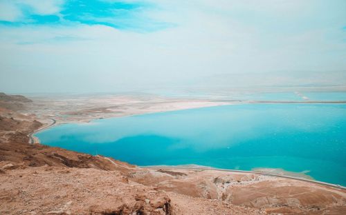
The Dead Sea is considered the most saline body of water with a salinity of 231 per mille, which is more than six times the average salinity of the oceans.
The greatest depth is 5,267 m (17,280 ft) - Calypso Deep - in the Ionian Sea.
EUROMED is a platform for cooperation between the member states of the European Union and 12 Mediterranean countries, initiated in Barcelona in 1995.
Algeria, Gibraltar, Spain, France, Monaco, Italy, Malta, Slovenia, Croatia, Bosnia and Herzegovina, Montenegro, Albania, Greece, Cyprus, Turkey, Syria, Lebanon, Israel, Egypt, Libya, Tunisia, and Morocco.
This strait separates Africa from Europe, between present-day Morocco and Ceuta (a Spanish autonomous city on the north coast of Africa) and Spain and Gibraltar (a British Overseas Territory). The strait is about 300 m deep and has a width of 14 km.
The Dardanelles are located between the Balkan Peninsula and Asia Minor and connect the Aegean Sea with the Sea of Marmara. They are 61 km long and 1.3-18.5 km wide. In ancient times Dardanelles were known as the Hellespont.
The western basin includes the Alboran, Balearic, Ligurian and Tyrrhenian Seas, while the eastern basin includes the Ionian, Adriatic, Aegean and Icarian Seas.
Their coast length is about 18,000 km, which is almost 40% of the total Mediterranean coastline. Among the islands are both the larger ones (Sicily, Crete, Cyprus, Malta, Corsica, Sardinia) and the smaller ones (Balearic and Aegean islands).
The region was the birthplace of many initiatives and thoughts. From here, new directions and achievements in art and technology spread throughout the world. From here also set out the great expeditions to conquer the New World.
The coasts are rocky, interspersed with sandy beaches and bays. The plateaus there are mostly between 200 and 500 meters above sea level, with the highest and widest in central Spain.
The climate in this region is characterized by warm, dry summers and mild winters. The water temperature of the sea reaches up to 28 °C (82 °F) in summer. The vegetation there is evergreen and characteristic bushy plant formation of the region is the maquis.


